Precision, innovation, and expertise define SGi’s aerial survey and filming capabilities. Leveraging advanced LiDAR (Light Detection and Ranging) technology, we provide highly accurate, three-dimensional mapping and terrain analysis for clients across Indonesia. This cutting-edge system, integrated into our versatile helicopter fleet such as the Bell 407 HP “Eagle,” enables detailed data collection in regions that are otherwise difficult or impossible to access by land.
LiDAR technology allows projects that would traditionally take months to complete on the ground to be achieved within days, significantly improving efficiency while reducing risk and environmental impact. Beyond mapping, our aerial filming services have supported a wide range of industries and events, from infrastructure and environmental assessments to international broadcasts, capturing exceptional visuals from a safe and controlled aerial platform.
With proven experience in complex operations, including large-scale terrain mapping in Papua, SGi combines aviation precision, technical innovation, and a strong safety culture to deliver reliable solutions for exploration, documentation, and creative production. Wherever the project is located, our commitment remains the same: to deliver results that meet the highest standards of accuracy, efficiency, and safety.
AERIAL FILMING
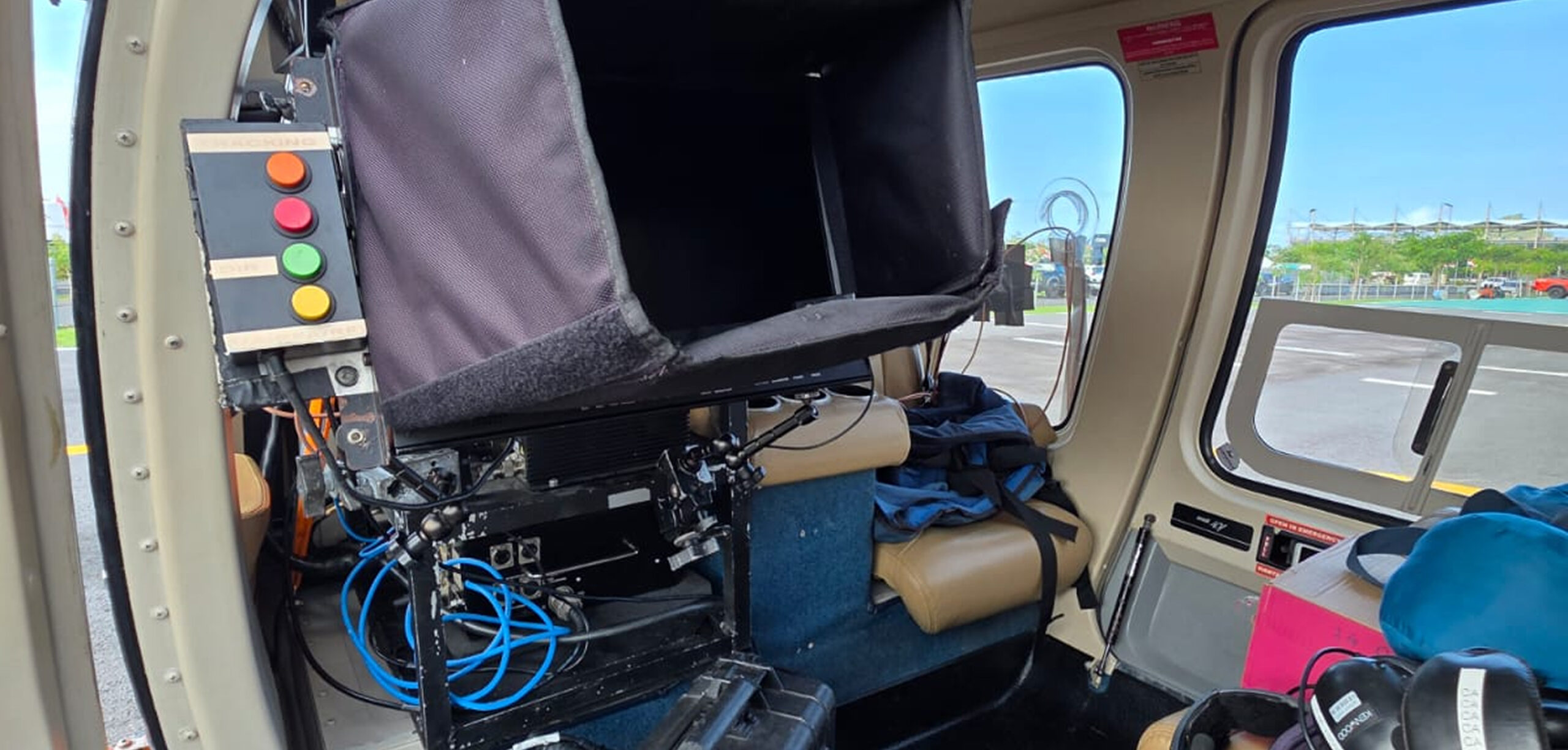
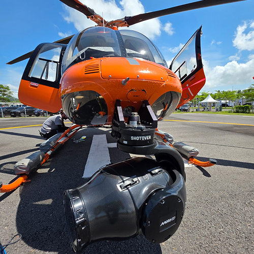
Beyond survey operations, SGi is also a trusted partner for aerial photography and filming. Our extensive experience includes collaboration with MotoGP™ at the Mandalika International Circuit, where our Bell 407 GXP helicopter played a vital role in capturing the energy and precision of one of the world’s most thrilling races.
Working closely with Dorna Sports, our aerial crew provided dynamic overhead footage that brought the race to life for millions of viewers around the globe. Beyond delivering spectacular visuals, the helicopter also functioned as an aerial command and safety platform, giving race officials a real-time overview of the track and enabling rapid response to on-ground incidents.
SGi takes great pride in contributing to such world-class events. Our aerial capabilities not only enhance visual storytelling but also ensure operational efficiency and safety from above. Whether it’s mapping rugged landscapes or filming international sporting events, SGi continues to set new standards in precision, reliability, and innovation across Indonesia’s skies.
For over 23 years, SGi has supported government agencies and humanitarian organizations in urgent rescue situations. Our ability to operate in remote, high-risk, and logistically challenging environments has made us a trusted partner for life-saving missions across the region.